
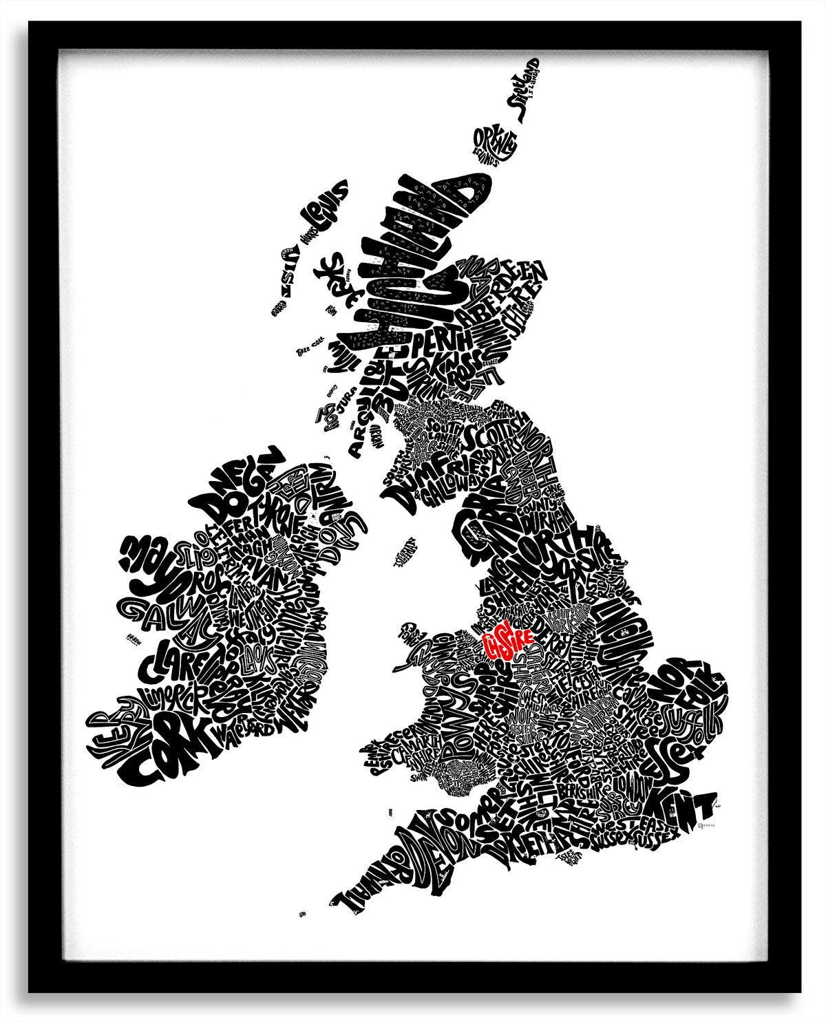


Love where you live? This typographic map of the United Kingdom and Republic of Ireland uses hand drawn lettering to show all the main counties (or council areas) in England, Wales, Scotland, Northern Ireland and Republic of Ireland – and can be personalised to highlight an area or areas that are special to you. Originally hand drawn, the map also includes lots of hidden local area landmark illustrations, from castles to giraffes!
There are three options:
A. Unpersonalised - no areas are highlighted. If to be framed, also specify if you want a black or white frame.
B. 1-2 areas highlighted. In the Notes box at checkout, specify the areas you want highlighted and the highlight colour - choose from teal, blue, red, pink, orange or grey. If to be framed, also specify if you want black or white frame.
C. 3-9 areas highlighted. In the Notes box at checkout, specify the areas you want highlighted and the highlight colour - choose from teal, blue, red, pink, orange or grey If to be framed, also specify if you want black or white frame.
Highlight colours are:
Red
Blue
Pink
Teal
Orange
Grey
Maps are available in the following sizes:
A3 - 420mm x 297mm
A2 - 594mm x 420mm
A1 - 840mm x 594mm
A0 - 1188mm x 840mm
Please note - all illustrations will not be visible at A3 size
Every map is a high quality Giclée print on 300gsm archival paper. Unframed, prints are shipped flat (A4 & A3) or in a tube (A2-A0).
There is a choice of black or white frames. A2/A3/A4 frames have a 15mm moulding with glass (A3/A4) or acrylic (A2) fronts. A1/A0 frames have a 40mm moulding frames with acrylic panels. Any framed map to be sent outside the UK has an acrylic front.
Please allow 7-10 working days for production and delivery.
ADDITIONAL CUSTOMISATION
For any other customisation options (including different maps colours, bespoke markers and other highlight colour options, please contact [email protected]
MAP AREAS
Areas included on the map are:
ENGLAND:
Bedfordshire
Berkshire
Bristol
Buckinghamshire
Cambridgeshire
Cheshire
Cornwall
Cumbria
Derbyshire
Devon
Dorset
County Durham
East Riding of Yorkshire
East Sussex
Essex
Gloucestershire
Greater Manchester
Hampshire
Herefordshire
Hertfordshire
Isle of Wight
Kent
Lancashire
Leicestershire
Lincolnshire
London
Merseyside
Norfolk
North Yorkshire
Northamptonshire
Northumberland
Nottinghamshire
Oxfordshire
Rutland
Shropshire
Somerset
South Yorkshire
Staffordshire
Suffolk
Surrey
Tyne and Wear
Warwickshire
West Midlands
West Sussex
West Yorkshire
Wiltshire
Worcestershire
WALES
Blaenau Gwent
Bridgend
Caerphilly
Cardiff
Carmarthenshire
Ceredigion
Conwy
Denbighshire
Flintshire
Glamorgan
Gwynedd
Anglesey
Merthyr Tydfil
Monmouthshire
Neath Port Talbot
Newport
Pembrokeshire
Powys
Rhondda Cynon Taf
Swansea
Torfaen
Wrexham
SCOTLAND
Aberdeen
Aberdeenshire
Angus
Argyll and Bute
Edinburgh
Clackmannanshire
Comhairle nan Eilean Siar
Dumfries and Galloway
Dundee
East Ayrshire
East Dunbartonshire
East Lothian
East Renfrewshire
Falkirk
Fife
Glasgow
Highland
Inverclyde
Midlothian
Moray
North Ayrshire
North Lanarkshire
Orkney Islands
Perth and Kinross
Renfrewshire
Scottish Borders
Shetland Islands
South Ayrshire
South Lanarkshire
Stirling
West Dunbartonshire
NORTHERN IRELAND
Antrim
Belfast
Armagh
Down
Fermanagh
Derry
Tyrone
IRELAND
Carlow
Cavan
Clare
Cork
Donegal
Dublin
Galway
Kerry
Kildare
Kilkenny
Laois
Leitrim
Limerick
Longford
Louth
Mayo
Meath
Monaghan
Offaly
Roscommon
Sligo
Tipperary
Waterford
Westmeath
Wexford
Wicklow
 in England, Wales, Scotland, Nort...)